Using the Free CADtoEarth addin to Import Google Earth Terrain and Satellite Imagery to Revit
I have posted about CADtoEarth before, but here is a quick 5 minute video using the latest version:
Open embedded content: screencast.autodesk.com
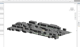
You can also import building models to Revit from Google Earth, but in my experience the families created by CADtoEarth are not realistic in terms of height:
Download CADtoEarth from:
https://apps.autodesk.com/RVT/en/Detail/Index?id=appstore.exchange.autodesk.com%3Acadtoearth%3Aen
Discussion
0 archived comments. New comments are not enabled.